The world is drowning in data while it gasps for answers about the next great flood. As extreme weather accelerates, the gap between having information and understanding it has become a dangerous chasm for emergency responders. Microsoft and NASA have launched a new initiative to close this distance by deploying artificial intelligence against the planet’s most unpredictable element. Their collaboration has produced Hydrology Copilot, a suite of AI agents designed to translate petabytes of complex water cycle measurements into actionable survival strategies.
• Microsoft and NASA launched Hydrology Copilot.
• The AI tool analyzes complex water data.
• It aims to help manage extreme weather.
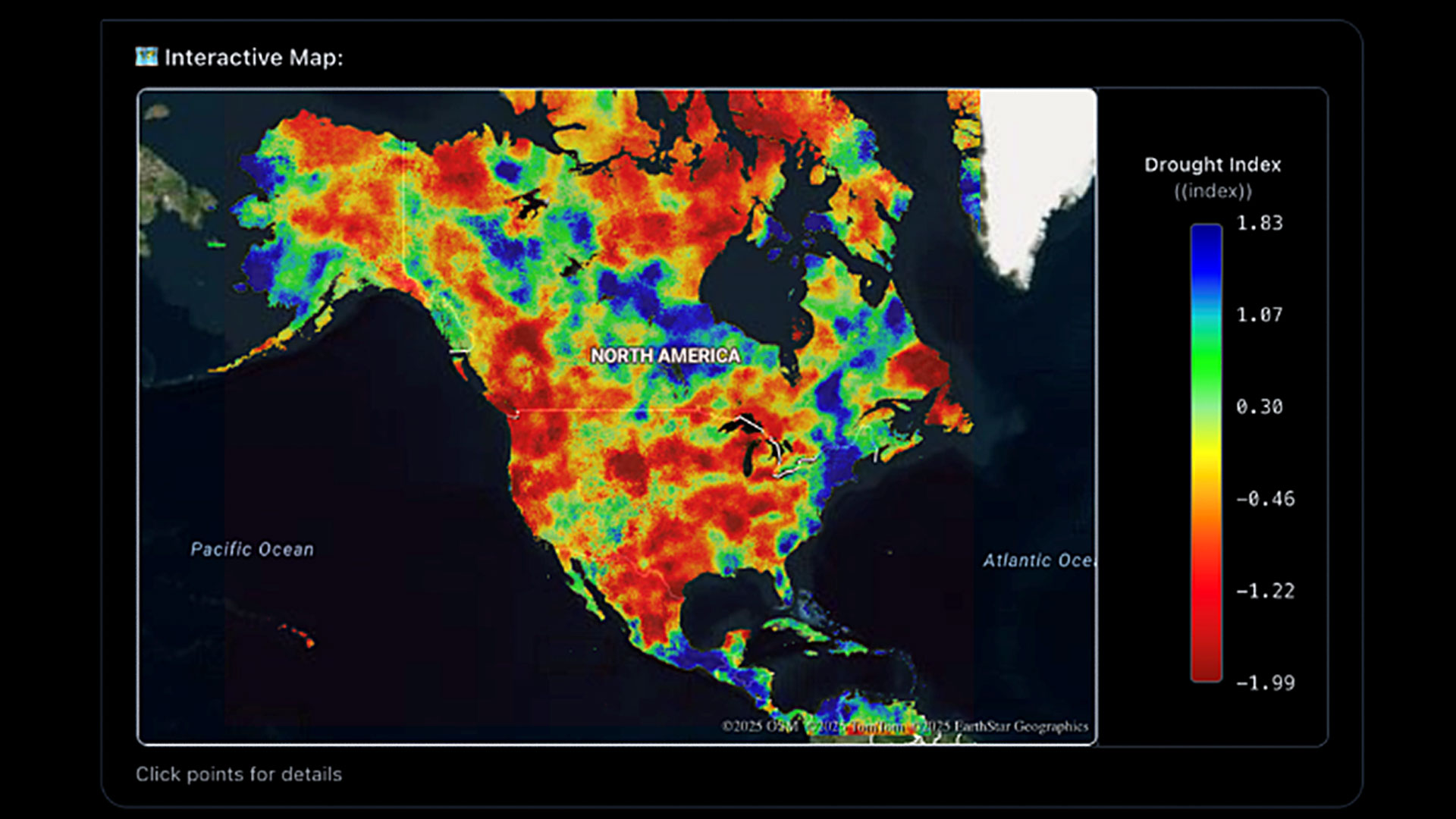
At the core of this system lies the North American Land Data Assimilation System Version 3, a massive repository of hydrological truth that has historically been impenetrable to the layperson. This dataset combines satellite readings with advanced computer modeling to create a high-resolution, continuous map of the continent’s water cycle. It tracks precipitation, runoff, and evaporation with rigorous precision, but until now, extracting insights required specialized technical expertise that most city planners simply do not possess.

• The system uses the NALDAS v3 dataset.
• It combines satellite and computer models.
• The data was previously hard to access.
The new platform dismantles these barriers by allowing users to interrogate the database using plain language rather than complex code. Powered by Microsoft’s Azure OpenAI Service, the interface lets researchers ask direct questions about which regions face immediate flood risks or severe drought conditions. This capability transforms a static archive of scientific observations into a dynamic conversation, enabling rapid analysis of soil moisture and water movement without the need for a background in data science.
• Users can ask questions in plain English.
• The system runs on Microsoft Azure OpenAI.
• No coding skills are needed for analysis.
Recent atmospheric river events in the Pacific Northwest have underscored the lethal necessity of this technology. The insights derived from the AI are intended to guide local officials and emergency crews who must make split-second decisions during such hydrological crises. Beyond immediate disaster response, the tool offers critical foresight for long-term agricultural planning and urban development, helping communities adapt their infrastructure to a climate where historical weather patterns no longer predict the future.
• The tool helps manage atmospheric rivers.
• It aids emergency responders and planners.
• Long-term agriculture benefits from the data.
Access to this digital oracle is currently limited to researchers as the system undergoes further development. The ultimate goal is to democratize this environmental intelligence, putting the power of NASA’s satellites into the hands of the local decision-makers who need it most. While the tool refines its predictive capabilities, the broader public can access other existing hydrological maps to understand the shifting waters around them.
• The tool is currently for researchers only.
• The goal is to democratize satellite data.
• Public maps are available elsewhere for now.